Last updated: September 2026. We re-checked the FCDO’s Iraq advice on gov.uk on 25 September 2026 and the Zagros Mountain Trail’s own site the same day. Mountain heights, park status and mine data come from our August 2026 research files and Kurdistan24’s reporting on the Kurdistan Mine Action Agency (August 2025); each figure is dated where it appears.
Iraqi Kurdistan has the highest mountains in Iraq, a 215 km long-distance trail with village homestays, and some of the most mine-contaminated land on earth. All three facts belong in the same sentence, because the third decides how you should approach the first two. This page, part of our Iraqi Kurdistan travel guide, is written for walkers who want the mountains without learning about the minefields the hard way.
The short version of Kurdistan hiking: the Zagros ranges of Iraq’s Kurdistan Region offer everything from forest walks on Safeen above Shaqlawa to the 13-stage Zagros Mountain Trail and Mount Halgurd, at 3,607 m the highest peak wholly inside Iraq. Walk with a local guide, on known paths, and treat every unmarked slope near a border as suspect.
Below: the safety frame, including the mines and the border areas, the best hiking regions from Duhok to Halabja, the real heights of the peaks, seasons, guides and permits, and what we could not confirm.
The short answer
| Question | Answer |
|---|---|
| Best long-distance route | The Zagros Mountain Trail: 215 km in 13 stages, from Shush to the foot of Halgurd, with community guides and homestays |
| Highest peak | Halgurd, 3,607 m, the highest wholly inside Iraq; Cheekha Dar, 3,611 m on the Iranian border, is the country’s high point |
| Biggest hazard | Landmines and unexploded ordnance, especially near borders; 13 mine casualties were recorded by August in 2025 |
| Permits | No park permit exists; Peshmerga checkpoints control access to the high country |
| Best seasons | Spring and autumn for most areas; midsummer for the high valleys around Choman |
| FCDO (25 September 2026) | All but essential travel to the whole Kurdistan Region |
| Guide needed? | Not by law as far as we can find, but in practice yes |
Is it safe to hike in Iraqi Kurdistan?
Start with the mines, because nothing else on a Kurdish mountain is as likely to kill you. The Kurdistan Region was fought over in the Iran-Iraq war of the 1980s, in the Ba’ath regime’s campaigns against the Kurds, in the war with the Islamic State group and in decades of border fighting. On 27 August 2025, a 25-year-old man, Karzan Mirza from Nawanda village, was killed by a landmine in the Khwari Miran highlands on the slopes of Mount Halgurd, in Choman district. Kurdistan24 reported that the mines there are remnants of the Iran-Iraq war, and that the Kurdistan Mine Action Agency in Erbil had counted 13 casualties that year, six killed and seven injured.
The FCDO’s advice is blunt: landmines are present in rural areas, particularly border areas, and a number of people are killed each year; some areas have warning signs, but not all. How much land is affected depends on whose figure you read.
| Source | Figure | What it actually measures |
|---|---|---|
| Kurdistan24, citing mine-action data (August 2025) | 650 million m² contaminated in Iraq; 314 million m² in the Kurdistan Region | Land still recorded as contaminated at the time |
| Our mine-action research file (2026) | About 776 km² contaminated in the Kurdistan Region, about 576 km² cleared, about 200 km² remaining | Cumulative recorded contamination, with the cleared and remaining shares |
| Our mine-action research file (June 2026) | About 4,800 km² across Iraq | A national estimate; its method isn’t stated in our file |
| Landmine Monitor, quoted by Kurdistan24 | “Iraq has the most landmines of any country worldwide” | A global comparison, not an area |
The numbers differ because they count different things at different dates, but they agree on the point that matters: hundreds of square kilometres of the Kurdistan Region are still dangerous, and much of that is mountain. The rules that follow are not optional.
| Rule | Why |
|---|---|
| Walk with a local guide who knows the route | Contamination maps are not public, and local knowledge is the best protection you have |
| Stay on paths that are visibly in regular use | A well-worn track is the best evidence of safe ground |
| Never walk into unmarked ground near a border, ridge post or old military position | These are where mines were laid |
| Obey signs, fences and any painted markers | Marking is incomplete, so respect what exists |
| If you find yourself in a suspected minefield, stop and retrace your exact steps | Going forward or sideways is how people are hurt |
| Don’t touch metal objects on the ground | Unexploded ordnance is still found across the Region |
Then there are the borders. The FCDO’s safety page, when we read it in August 2026, noted that Iranian strikes on Iranian-Kurdish opposition groups had continued in parts of the Region, including around Rawanduz and Koya, and those groups live in the mountains. Along the Turkish border, the fighting between Turkey and the PKK has largely stopped since the PKK announced its dissolution in 2025, but we could not confirm whether Turkish military positions in the Duhok mountains have been withdrawn. Border ridges are not hiking terrain, whatever the map suggests.
As of 25 September 2026 the FCDO advises against all but essential travel to the whole Kurdistan Region; the US State Department rates Iraq Level 4, Do Not Travel, reissued on 2 March 2026; and the FCDO warns that “your travel insurance could be invalidated” if you travel against its advice. Many policies exclude mountaineering or high-altitude trekking anyway, so check both points in writing. Our guides to travel insurance for Iraq, safety in Kurdistan and the current travel advisory go into more detail.
Where are the best hikes in Iraqi Kurdistan?
Kurdistan’s hiking falls into a handful of regions, each with its own character and caveats. Our wider guide to nature in Iraq puts them in the context of the country’s other landscapes.
| Area | Governorate | What it offers | Caveat |
|---|---|---|---|
| Zagros Mountain Trail | Duhok and Erbil | 215 km in 13 stages with guides and homestays | Book through the trail’s own organisers |
| Halgurd and Choman | Erbil (Soran administration) | Iraq’s highest mountains, snow into summer | Mine casualties in 2025; checkpoints |
| Rawanduz and Korek | Erbil | Gorge walks, waterfalls, a cable car to 2,000 m | The FCDO names the Rawanduz area for strikes |
| Safeen and Shaqlawa | Erbil | Wooded slopes 51 km from Erbil | Routes unmarked |
| Akre | Duhok | Trails, caves, springs and a castle climb | Steep, rocky ground |
| Amedi and Gara | Duhok | Valleys, springs and high ridges | Former PKK-Turkey conflict zone |
| Sulaymaniyah and Halabja | Sulaymaniyah and Halabja | Azmar, Goizha, Piramagrun, Mawat, Hawraman | Camping and fires banned on Azmar and Goizha since May 2025 |
The Zagros Mountain Trail
The Zagros Mountain Trail is the closest thing Iraq has to a long-distance footpath. According to its own site, it runs 215 km in 13 stages from the village of Shush to the foot of Mount Halgurd, by way of Akre, Hashtga, Safti, Alka, Harbo, Khalan, Soran, Rawanduz, Saran, Dargala, Rezan and Choman. It links more than 30 rural communities and dozens of archaeological, religious and cultural sites, and it is run through local guides and host families, so the money stays in the villages. The site publishes no prices, season or safety notes on its home page; you sign up or contact the organisers directly.
That structure is the trail’s great strength for a foreign walker: you are passed from guide to guide and host to host, people who know which paths are used and which aren’t. It also means you should not treat the published stage list as a self-guided route. The trail passes through Akre and the Rawanduz gorge, so it can be sampled in sections as part of a wider trip.

Mount Halgurd and the Halgurd-Sakran park
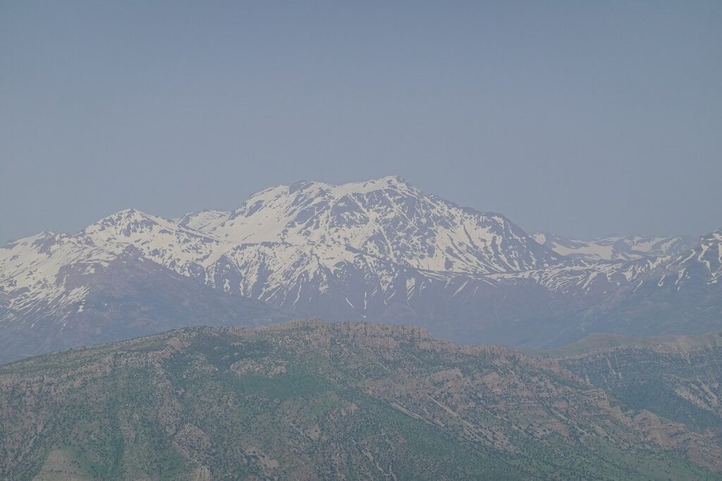
Halgurd is the prize. At 3,607 m it is the highest peak wholly inside Iraq, snow lingers on it well into the warm months, and it is the eastern end of the Zagros Mountain Trail. On paper it sits in the Halgurd-Sakran National Park, created by regulation in 2011. In practice the park’s management committee was never formed and work stopped in 2014, so it is unstaffed: there is no entry fee and no park permit, and access is controlled by Peshmerga checkpoints. There are no rangers to rescue you.
The August 2025 death in the Khwari Miran highlands happened on Halgurd’s slopes. That doesn’t make the mountain off-limits, but it does make a guide non-negotiable. Go in summer, when the approach is free of snow, carry your passport for the checkpoints, and plan with someone who has walked the route recently.
Choman and Balakayati
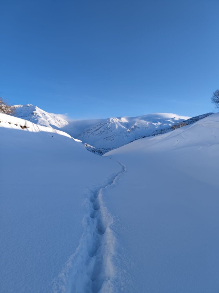
Choman district, on the approach to Halgurd, is the Kurdistan Region’s high summer country. Its tourism directorate told Kurdistan24 that more than 30,000 visitors came to the Balakayati area in July 2026, and that temperatures there “rarely exceed 30 °C” in summer, with snow lingering on some mountains all year. The area covers Choman district, four sub-districts and about 120 villages, with more than 40 established tourist sites and over 220 xanebaxe, the small orchard cottages families rent in summer. Invest Kurdistan even captions photographs of skiing there.
Rawanduz, Korek and the Hamilton Road
The gorge country around Rawanduz is the most accessible mountain scenery in the Region, and the Korek cable car does the climbing for you: a four-kilometre Doppelmayr lift from about 650 m to a top station at 2,000 m, below a summit of 2,076 m. Walking here is mostly short routes from the road, the waterfalls and the cable car’s top station rather than serious trekking. Our guide to Rawanduz and the Hamilton Road covers the gorge, Gali Ali Beg and Bekhal in detail, including the FCDO’s note on Iranian strikes in the area.
Safeen and Shaqlawa
Safeen is the mountain above Shaqlawa, the old hill station 51 km north-east of Erbil, and its wooded slopes are the nearest proper walking to the capital. No official trail map is published, so go with an Erbil-based hiking group or a local guide. Our list of things to do in Erbil includes Shaqlawa among the day trips.
Akre, Amedi and the Duhok mountains
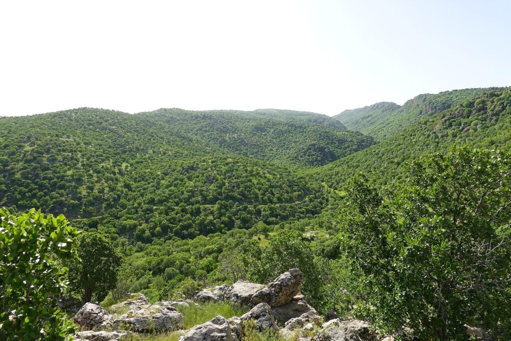
The Duhok mountains are wilder and, until recently, more troubled. Around Akre, Shafaq News points walkers to hiking trails, caves and cold springs, and the climb to the old castle is a steep, rocky scramble. Around Amedi there are the wooded valleys of Sulav and the ridges of Gara, at 2,151 m, where a US$25 million cable car was licensed in July 2026. The Metina, Zap and Avashin areas further north were targets of Turkey’s 2022 offensive against the PKK and remain border country: stay out of them.
Sulaymaniyah, Hawraman and Halabja
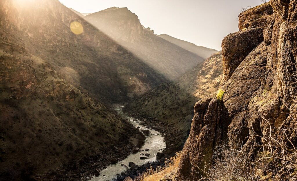
Sulaymaniyah sits beneath Azmar and Goizha, whose slopes are the city’s weekend playground. Since May 2025 camping and fires have been banned on both mountains, and their true summits are military or fenced off with unexploded ordnance beside the ridge road; we found no published trail maps or trailheads. Further afield, Piramagrun, at about 2,611 m, is a serious mountain walk, the Mawat area has deep river valleys, and the Hawraman highlands above Halabja lead to the Ahmed Awa waterfall. Our Sulaymaniyah guide covers the city as a base.
A sample week of Kurdistan hiking
If you have a week and want a taste of everything, this loop from Erbil works in late spring or early autumn, with Halgurd reserved for high summer. It uses only places covered on this page, and it assumes a driver and, for the mountain days, a local guide. We give no drive times, because no official source publishes them.
| Day | Where | What | Base |
|---|---|---|---|
| 1 | Shaqlawa and Safeen | A first forest walk on Safeen’s slopes | Shaqlawa or Erbil |
| 2 | The Hamilton Road | Gali Ali Beg, Bekhal and short walks along the Rawanduz gorge | Soran or Rawanduz |
| 3 | Korek | The cable car to about 2,000 m and walks from the top station | Soran |
| 4 and 5 | Choman and Balakayati | High valleys and village paths, with a guide | Choman or an orchard cottage |
| 6 | Halgurd approach | A guided day towards Halgurd, in summer only | Choman |
| 7 | Back down the Hamilton Road | Return, with a stop wherever the gorge tempts you | Erbil |
Swap days 4 to 6 for a section of the Zagros Mountain Trail if you would rather walk from village to village, or add two days at the other end of the Region for Sulaymaniyah’s mountains and the Hawraman highlands.
How high are Kurdistan’s mountains?
Heights are a small but telling test of a source. The figure most often printed for Halgurd, 3,726 m, has no source we could find, and it makes Halgurd taller than Iraq’s actual high point. These are the figures we trust.
| Mountain | Height | Note |
|---|---|---|
| Cheekha Dar | 3,611 m | Iraq’s highest point, on the Iranian border |
| Halgurd | 3,607 m | The highest peak wholly inside Iraq; ignore the unsourced 3,726 m |
| Sakran (Haji Ibrahim) | 3,587 m | Neighbour of Halgurd in the same park |
| Piramagrun | About 2,611 m | Sulaymaniyah governorate |
| Gara | 2,151 m | Amedi district, Duhok governorate |
| Korek | 2,076 m | Cable car to about 2,000 m |
| Azmar | About 1,696 m | Above Sulaymaniyah; summit area military or fenced |
When is the best season for Kurdistan hiking?
For most of the Region, spring and autumn. From March to May the hills are green and the rivers full; October and November are dry, clear and cooler. Summer on the plains is brutal, with Erbil’s average August high around 42 °C, but the high valleys of Choman stay below about 30 °C, which is why they fill with families in July. Halgurd itself is a summer objective, once the snow has retreated from the approaches. Winter brings snow to the high ground and real mountaineering conditions.
Holidays change the picture. At Eid and Newroz, from 21 March, the popular valleys and waterfalls are crowded, and the Newroz fire climb at Akre on the evening of 20 March is a walk of a very different kind. Our guide to the best time to visit Iraq covers the seasons country-wide.
Guides, permits and practicalities
| Item | What we know |
|---|---|
| Guides | The Zagros Mountain Trail works through community guides. We found no official guide licensing scheme |
| Park permits | None: the Halgurd-Sakran park is unstaffed and charges nothing |
| Checkpoints | Peshmerga checkpoints control access to the high country; carry your passport |
| Visa | A Kurdistan Region visa, valid in the Region only |
| Where to sleep | Homestays on the Zagros Mountain Trail; orchard cottages in Balakayati; hotels in the towns |
| Camping | Banned on Azmar and Goizha since May 2025; elsewhere, ask locally |
| Rescue | No mountain rescue service is published; plan as if there is none |
The checkpoints are routine but real; our guide to Iraq’s checkpoints explains what to expect, and our Kurdistan visa guide covers the paperwork. Mobile coverage fades in the high valleys, so buy a local SIM before you leave the city; our Iraq SIM card guide compares the networks. Pack for big temperature swings, sun and rough ground, and carry more water than you think; our Iraq packing list has the details. If you would rather have logistics handled, our guide to Iraq tours explains what to ask an operator, starting with who their guides are and how they handle mine risk.
What to pack
| Item | Why |
|---|---|
| Boots with ankle support and grip | Most mountain paths are rocky and loose |
| Layers and a warm jacket | Big swings between valley heat and cold heights; snow at altitude into spring |
| Sun hat, sunglasses and sunscreen | Little shade above the tree line |
| More water than you think | We found no published information on safe springs |
| Passport, visa and photocopies | Checkpoints on the approach roads |
| Offline maps and a charged power bank | Coverage fades in the high valleys |
| Modest clothing for villages | Long trousers and covered shoulders are the norm |
Village etiquette on the trail
Much Kurdistan hiking crosses farmland and passes through villages, and the paths often belong to someone. Greet people you meet, ask before crossing orchards or fields, keep dogs and flocks at a distance, and ask before photographing anyone, particularly women. If you are offered tea, which is likely, accept it: the conversation is part of the walk. During Ramadan, don’t eat or drink in front of people in villages during daylight. Leave nothing behind, including fires: the bans on Azmar and Goizha exist for a reason.
What we could not confirm
- Zagros Mountain Trail prices, season and 2026 operation. The trail’s site publishes none; contact the organisers.
- Mine maps for hiking areas. Contamination maps are not published for walkers; we could not confirm which routes have been surveyed or cleared.
- Turkish military positions. Whether any in the Duhok mountains have been withdrawn in 2026.
- Mountain rescue. We found no published rescue service or emergency number for the high country.
- Trail maps for Safeen, Azmar, Goizha and Piramagrun. None published; routes and trailheads are local knowledge.
- Camping rules outside Azmar and Goizha. No Region-wide rule is published.
- Guide licensing. We found no official scheme, and so no way to verify a guide’s credentials except by reputation.
- Named hiking groups and operators. Hiking groups and operators advertise trips from Erbil and Sulaymaniyah, but we could not verify which are trading in 2026, so we name none.
- Korek cable car prices and hours. The lift ran a full 2025 to 2026 winter season; its fares are not verified.
Frequently asked questions
Is it safe to go hiking in Iraqi Kurdistan?
It can be, with the right precautions. The biggest risk is landmines: a man was killed on Halgurd’s slopes in August 2025, and hundreds of square kilometres of the Region remain contaminated. Walk with a local guide on well-used paths and avoid border ridges. The FCDO advises against all but essential travel to the Region, as of 25 September 2026.
How high is Mount Halgurd?
3,607 m, which makes it the highest peak wholly inside Iraq. Cheekha Dar, on the Iranian border, is slightly higher at 3,611 m and is the country’s highest point. The 3,726 m often printed for Halgurd has no source we could find and should be ignored.
What is the Zagros Mountain Trail?
A 215 km long-distance trail in 13 stages across the Kurdistan Region, from the village of Shush to the foot of Mount Halgurd, via Akre, Soran, Rawanduz and Choman. It is run through local guides and host families in more than 30 villages. Its website takes sign-ups but publishes no prices or season.
Do I need a permit to hike Halgurd?
No park permit exists: the Halgurd-Sakran National Park was created in 2011 but never staffed, and charges nothing. Access is controlled by Peshmerga checkpoints, so carry your passport and visa, and go with a local guide who knows both the route and the checkpoints.
When is the best time for hiking in Iraq?
Spring, from March to May, and autumn, in October and November, suit most areas. Summer is too hot on the plains but ideal in the high valleys around Choman, where temperatures rarely exceed 30 °C, and for Halgurd once the snow has cleared. Winter brings snow to the high ground.
Can you hike in Kurdistan without a guide?
On busy, well-used paths near towns, many people do. For anything remote, high or near a border, we wouldn’t: mine contamination is not mapped for walkers, there is no published mountain rescue service, and a local guide’s knowledge of which paths are used is the best safety equipment you can take.
Are there organised hiking tours in Kurdistan?
Yes. The Zagros Mountain Trail itself is organised around local guides and host families, and several international and local operators advertise guided treks in the Region. We could not verify which are trading in 2026, so we name none; ask any operator who its guides are, how it handles mine risk and what its insurance covers.
Final thoughts
The mountains of Iraqi Kurdistan are real mountains, high, empty and beautiful, and they are barely known outside the country. The walking culture is growing, the Zagros Mountain Trail has given it a spine, and Kurdish families have made the high valleys their summer refuge. It is a good moment to go.
It is also a place where the past is still in the ground. Walk with people who know the paths, stay off border ridges, and don’t let a map persuade you that a slope is safe because nobody has marked it.
For the rest of the trip, Duhok is the gateway to the western mountains, our list of beautiful places in Iraq gathers the best scenery, and the rest of our Kurdistan Region coverage fills in the towns in between.
Photo credits
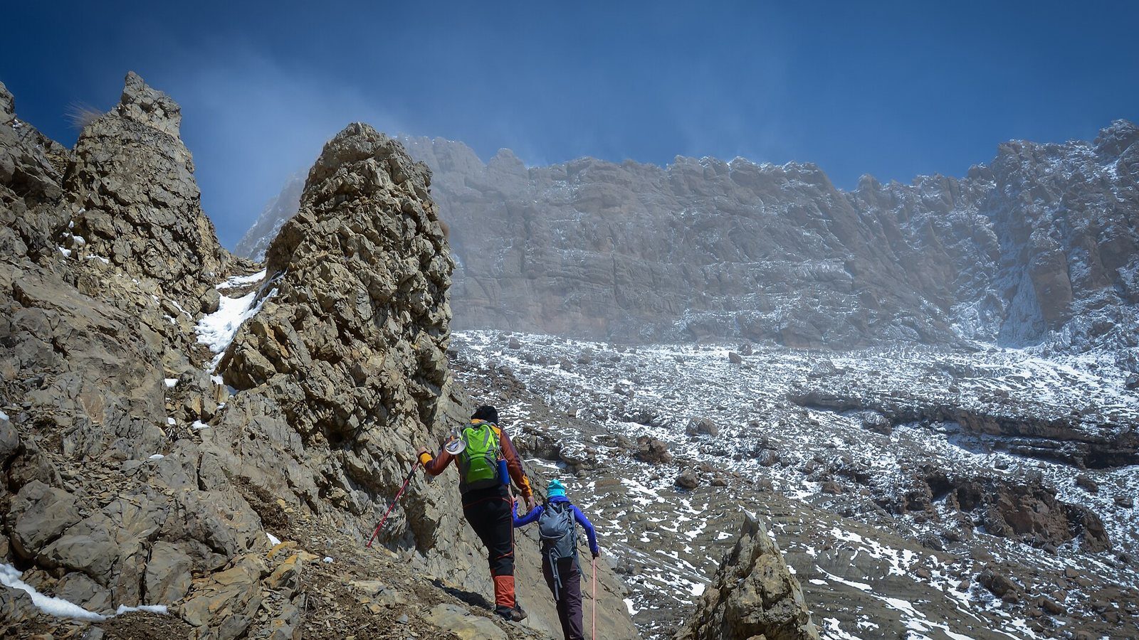
Hikers on Piramagrun (featured image): Hiwa Sherzad, Wikimedia Commons (CC BY-SA 4.0). River walk, Duhok governorate: Levi Clancy, Wikimedia Commons (CC BY-SA 4.0). Mount Halgurd from Korek: Khoshhat, Wikimedia Commons (CC BY 4.0). Shora village, Choman: Balaktribe, Wikimedia Commons (CC0). Safeen mountain: Khoshhat, Wikimedia Commons (CC BY 4.0). Mawat, Sulaymaniyah governorate: Hiwa Sherzad, Wikimedia Commons (CC BY-SA 4.0). All images via Wikimedia Commons under the licences shown.