Last updated: September 2026. We re-checked the FCDO’s Iraq advice on gov.uk on 25 September 2026. History and dating follow the Columbia University Mapping Mesopotamian Monuments survey and the sources named in the text; restoration news comes from Kurdistan24 (November 2025 to August 2026) and practical details from Shafaq News (May 2025).
Two claims follow Amedi around the internet: that it is 4,000 years old, and that the carvings by its old gate are Assyrian. The first is a round number of tradition, the second is simply wrong, and our Iraqi Kurdistan travel guide would rather give you the dated version. The oldest firmly dated things on the rock are Parthian reliefs of about the 2nd century AD, and the town’s Arabic name comes from a citadel built in 1142.
Amedi (Amadiya in Arabic) is a small walled town on a flat-topped mesa in the mountains of Duhok governorate, roughly 70 to 90 km north-east of Duhok depending on the source. It was the seat of the Bahdinan emirate for almost five centuries, and today it is free to walk, with a medieval minaret, a restored gate and a 16th-century school.
This guide covers how to get there, what the FCDO’s July 2026 change means for Amedi in particular, the town’s history layer by layer, what to see on and around the mesa, and the long list of things nobody has pinned down, starting with how high it is.
The short answer
| Question | Answer |
|---|---|
| Where is it? | Amedi district, Duhok governorate, inside the Kurdistan Region proper |
| Distance from Duhok | About 70 km (Kurdistan24, 2026) or 90 km (KRG tourism board); 1.5 to 2 hours by car |
| Entry fee | Free to enter the town (Shafaq News, May 2025) |
| Opening hours | None published for any site in the town |
| FCDO position (25 September 2026) | All but essential travel, like the rest of the Region; the old “against all travel” carve-out for the Amedi mountains was removed in July 2026 |
| Best season | April to October; July is hot but milder than the plains |
| Where to stay | No formal hotels in the town itself as of May 2025; motels and resorts nearby |
Where is Amedi, and how do you get there?
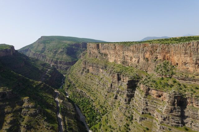
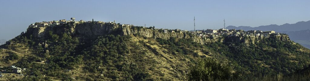
Amedi sits in the mountainous north-east of Duhok governorate, in Amedi district, one of the four districts that lie unambiguously inside the Kurdistan Region. That distinction matters: unlike Lalish or Alqosh, there is no disputed federal boundary on the way. The town fills the top of a mesa, with cliffs dropping away on most sides.
There is no direct public transport, according to Shafaq News, so the practical options are a car and driver from Duhok or Erbil, or an organised trip. Our Duhok city guide covers the nearest base, and our guide to getting around Iraq explains how drivers and shared taxis work. Even the distance depends on who you ask.
| Source | Figure | What it actually measures |
|---|---|---|
| Kurdistan24, 30 June 2026 | About 70 km north-east of Duhok | No route or method given |
| KRG General Board of Tourism (page dated 2015) | 90 km north-east of Duhok, “about one and a half hours by car” | A road figure from an old official page |
| Shafaq News, 3 May 2025 | About 90 km; 1.5 to 2 hours by car from Duhok | A road estimate, with a realistic time range |
The height of the mesa is even less settled. Shafaq News puts the town “at 912 meters above sea level”. One history website gives 1,985 metres, which is almost certainly wrong: it is inconsistent with the town’s own climate record, which puts July’s average daily maximum at 36.3 °C. Many travel pages print 1,200 to 1,400 metres without citing anything. We found no official survey figure, so we won’t choose between them.
Is it safe to visit Amedi in 2026?
Amedi’s position changed more than anywhere else in Iraq this summer. Until July 2026 the FCDO advised against all travel to the “Amedi Mountains Region” and to strips along the Turkish border, a stricter band than the rest of the Kurdistan Region. The edition of 22 July 2026 removed those carve-outs. As of 25 September 2026, the whole Region sits at “against all but essential travel”, and Amedi with it. That is materially better for Amedi, which has moved down a band, but anyone following FCDO advice to the letter is still travelling against it, and the FCDO warns that “your travel insurance could be invalidated” if you do. Our guide to travel insurance for Iraq explains what to ask your insurer.
The reason the mountains around Amedi had their own band was the long conflict between Turkey and the PKK, the Kurdistan Workers’ Party. Turkey’s Operation Claw-Lock, launched on 18 April 2022, explicitly targeted the Metina, Zap, Avashin and Basyan areas of Duhok province, and Kani Masi, a sub-district on the Turkish border, was shelled repeatedly between 2020 and 2024. Then the conflict wound down: the PKK announced its dissolution on 12 May 2025, destroyed weapons at a ceremony in Sulaymaniyah on 11 July 2025, and in October 2025 announced the withdrawal of its forces from Türkiye. The process then stalled over legal reforms, and in August 2026 Turkey’s governing party filed a peace bill that includes an effective pardon for former fighters.
On the ground, the KRG’s interior minister, Rebar Ahmed, held a press conference in Amedi district on 11 June 2026 and said “the cessation of fighting and clashes between the PKK and the Turkish army has brought calm back to the border areas”, while acknowledging “some issues remain beyond the control of the KRG”. A month later, on 16 July 2026, Duhok issued a US$25 million licence for an Austrian-built cable car on Gara Mountain, in Amedi district, one of the mountains where the fighting used to be. Money of that size is not a safety guarantee, but it is a data point. What we could not find is any source saying whether Turkish military bases in the district have been withdrawn.
The rest of the frame, as of 25 September 2026: the US State Department rates Iraq Level 4, Do Not Travel, reissued on 2 March 2026, and the FCDO’s safety page notes intermittent Iranian strikes on Iranian-Kurdish groups in other parts of the Region, around Koya and Rawanduz on the Hamilton Road. See our assessment of safety in Kurdistan and the dated summary on our Iraq travel advisory page.
How old is Amedi? The town in layers
The honest answer is: older than its name, but not as old as its reputation. Search summaries repeat a foundation around 3000 BC, and the KRG’s tourism board says only that the town was “built over 1,000 years ago”. The dated layers look like this.
| When | What happened |
|---|---|
| About 2nd century AD | Parthian-era rock reliefs carved beside what later became the western gate |
| 1142 | Imad al-Din Zengi builds a citadel on an earlier fortification called āšib; the Arabic name ʿAmadiyya comes from him, according to the historian ibn al-Athir |
| About 1160 | David Alroy, a messianic claimant born in Amedi, leads a revolt and is killed |
| 1163 | About a thousand Jewish families live in the town, trading in gall-nuts |
| 1376 to 1843 | Amedi is the seat of the semi-autonomous Bahdinan emirate |
| 1534 to 1576 | Reign of Sultan Hussein Wali, patron of the Qubahan School |
| 1760 | Dominicans found a mission; Maurizio Garzoni lives here 14 years and writes the first Kurdish grammar |
| 1907 | About 6,000 people: 2,500 Kurds, 1,900 Jews and 1,600 Chaldean Catholics |
| 1950 to 1951 | The Jewish community leaves in the exodus to Israel |
| 2023 and 2026 | The Bahdinan Gate is restored with US backing; a French-backed six-site restoration begins |
Several of those facts arrive in more than one version, and the differences are worth seeing side by side.
| Source | Claim | What it actually measures |
|---|---|---|
| Columbia University Mapping Mesopotamian Monuments (Bahrani and Almamori, journal IRAQ) | Three Parthian-era reliefs, documented in 2013; the gate itself Zengid, about 1142 | A field survey of what is carved on the rock |
| Michael G. Brown, Zeitschrift für Orient-Archäologie, 2018 | Two Parthian reliefs | A stricter count of what qualifies as a separate relief |
| Most travel pages | “Assyrian-style” figures | A guess from the style of the carving, not scholarship |
| Wikipedia and Kurdistan24 | Qubahan founded in the early 16th century under Sultan Hussein Wali | The founding patron’s reign, 1534 to 1576 |
| KRG tourism board | Qubahan “built in the 17th century” | No source given; it may reflect a later rebuilding, but we can’t tell |
| Wikipedia | Bahdinan emirate 1376 to 1843 | The standard scholarly range |
| KRG tourism board | The emirate lasted “until the end of the Ottoman Empire” | An error: the Ottoman Empire ended in 1922 |
One more story needs a flag. Many travel pages say the Three Magi of the Nativity set out from Amedi. It is a story told locally, and a lovely one, but we can find no documentary source for it, so treat it as legend.
What is there to see in Amedi?
Amedi has 57 registered historical sites, according to Kurdistan24’s August 2026 reporting (Shafaq News counted 13 officially registered archaeological sites in May 2025; neither report explains its register). Most visitors see half a dozen of them in a morning. None has published opening hours.
| Site | Dated to | Status in 2026 |
|---|---|---|
| Bahdinan Gate and reliefs | Gate about 1142; reliefs about 2nd century AD | Restored in 2023 |
| Great Mosque and minaret | 12th century | In use; restoration began August 2026 |
| Qubahan School | Early 16th century | Restoration due to finish in late 2026 |
| Tombs of the Sultans | Not dated in our sources | In the 2026 restoration programme |
| Synagogue ruins | Undated | In the 2026 restoration programme |
| Chaldean church and Pir Hazban shrine | Undated | Named in the June 2026 restoration reporting |
The Bahdinan Gate and the Parthian reliefs
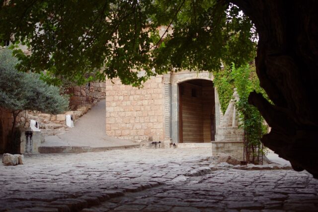
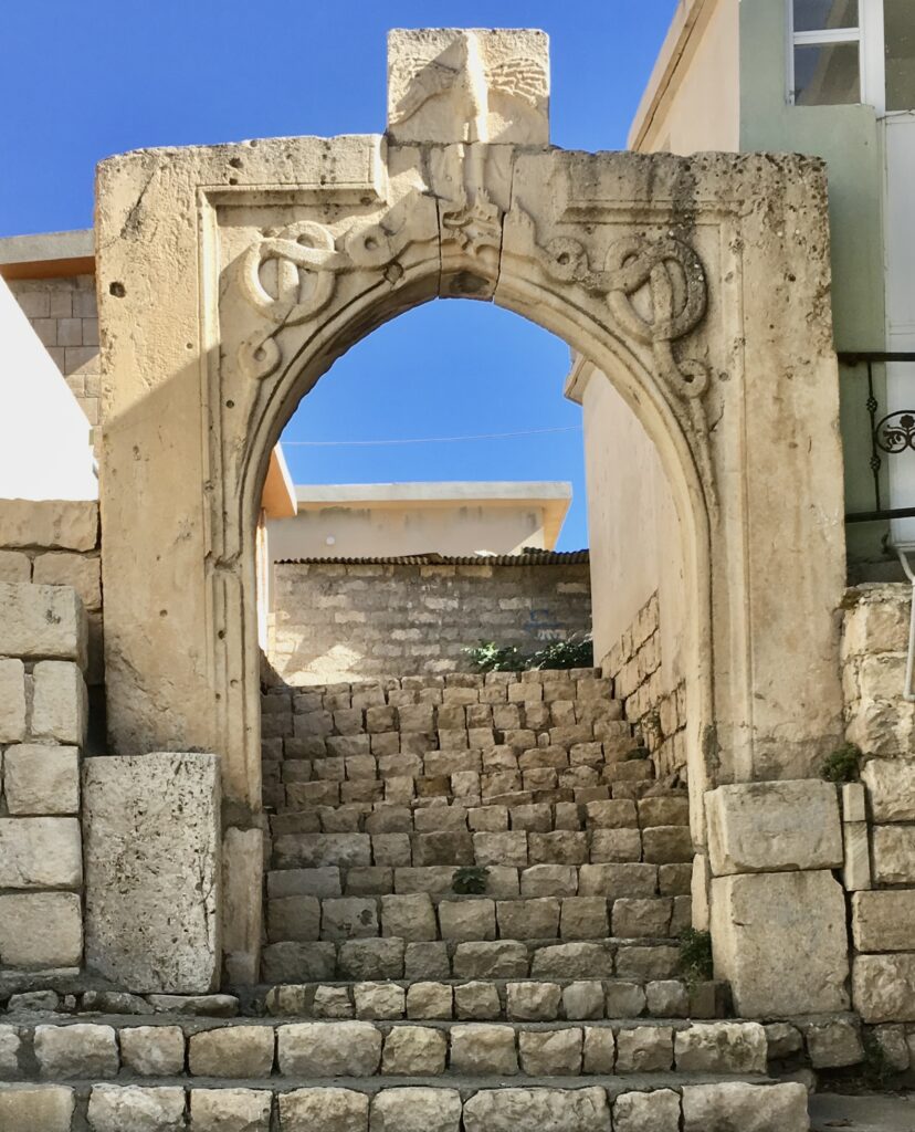
In the emirate’s day, Amedi had two main gates, the Zebar Gate to the east and the Bahdinan Gate, also called the Mosul Gate, to the west. The road to Mosul ran through the western one: Kurdistan24 describes “a large stone staircase of nearly 200 metres connected to a 4-metre-wide and 20-metre-high gate”. The gate itself is Zengid, of about 1142, and was restored in 2023 with United States backing. The figures carved into the rock nearby are the real antiquity: Parthian reliefs of around the 2nd century AD, a millennium older than the arch. The KRG’s tourism site also lists a “Zoroastrian Gate” among the sights; we could not establish whether that is a separate structure or another name for one of these.
The Great Mosque and its minaret
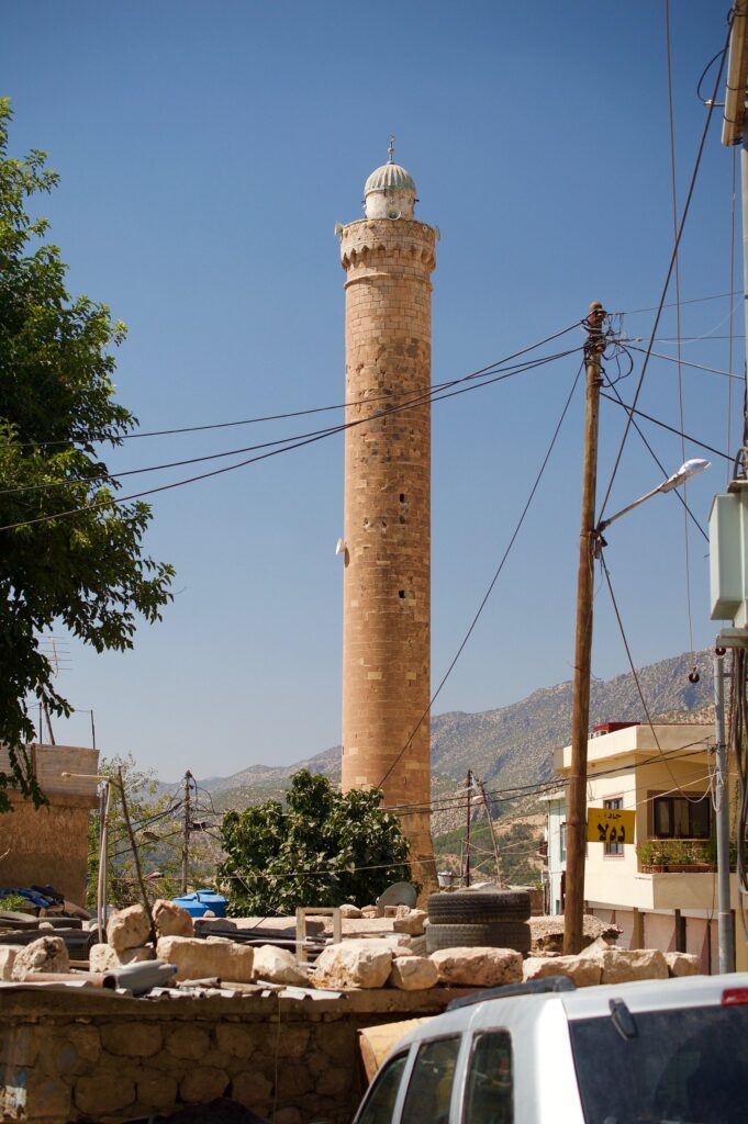
The minaret is the easiest landmark on the mesa to steer by. The mosque dates to the 12th century and Wikipedia calls it “the oldest and largest in the region”; it is still used by residents, so visit outside prayer times and dress accordingly. Restoration began in August 2026. The archaeologist Khalid Amedi told Kurdistan24 that “some interpretations of the sites’ history trace elements of their origins to Assyrian or Zoroastrian periods”: that is his reading, not an established fact.
Qubahan School
Qubahan takes its name from the Arabic qubba, dome. Founded in the early 16th century under Sultan Hussein Wali, it drew students from Kurdistan, Persia, Anatolia and the Arab world, and taught Quranic interpretation, Hadith and law alongside astronomy, medicine, philosophy and linguistics. Its library was said to hold thousands of manuscripts, most of them lost to wars and fires. People call it “the Oxford of Kurdistan”; Kurdistan24, which uses the phrase, adds sensibly that such comparisons “should be understood as symbolic rather than literal”. The ruins stand north-east of the town in a tree-filled garden. The Duhok antiquities director, Dr Bekas Brefkany, said the restoration was on course to finish later in 2026 after delays caused by unusually heavy rain earlier in the year.
The Tombs of the Sultans
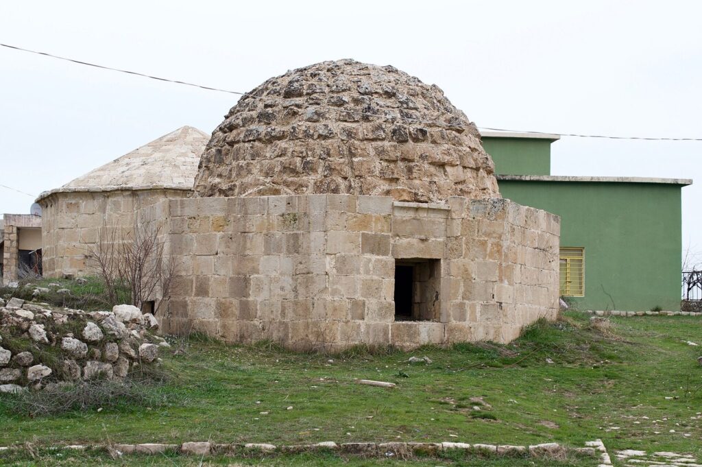
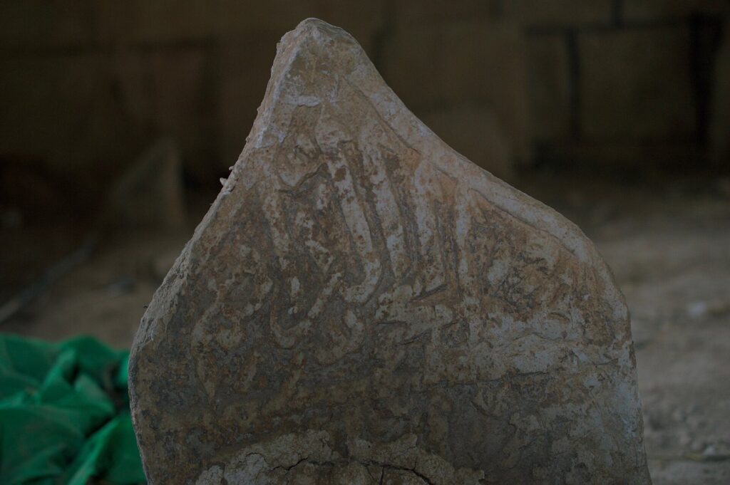
The domed tombs and carved gravestones of Amedi’s royal graveyard belong to the families who ruled the town. The Tombs of the Sultans are among the six sites in the 2026 restoration, and local officials have said plainly that earlier restorations were done without sufficient expertise and changed the buildings’ character. This time, according to Kurdistan24, specialists from two French universities are working from archival photographs with traditional materials and locally trained craftsmen.
Jewish and Christian Amedi
For most of its history Amedi was three communities on one rock. In 1163 about a thousand Jewish families lived here, and in 1907 Jews were still almost a third of the town. The synagogue survives as ruins and is part of the current restoration. The KRG also lists “the tomb of the Prophet Hazkiel”, dating it to 500 to 700 BC; that is the tourism board’s claim, and a better-known tomb of Ezekiel stands at Al-Kifl in Babil province. The community left in the 1950 to 1951 exodus, and its Jewish Neo-Aramaic dialect has been recorded in a scholarly grammar.
The Christian story is just as rich. In 1760 the Dominican Leopoldo Soldini founded a mission here with Maurizio Garzoni, who stayed fourteen years and compiled a 4,600-word Italian and Kurdish dictionary and grammar, the first study of Kurdish grammar, which is why he is called “the father of Kurdology”. A Chaldean church still stands, and the KRG lists the Mar Odisho church among its sights.
The stone belt walkway
The newest addition goes around the town rather than through it. In November 2025 Kurdistan24 reported a circular stone walkway of about 4 km around the mesa, 75 per cent complete, costing 2.3 billion dinars and paid for by the KRG, with a 400-metre link to the Qubahan School, lighting and side barriers. It was due to finish by the end of 2025. The historian Khalid Khayat said it “reveals natural scenes that could not be seen from existing routes”. We could not confirm that it has opened.
What is there around Amedi?
The valleys around the mesa are where most Iraqi visitors actually spend their day. Sulav, where in the KRG’s words “ice-cold water flows down from the mountain, into a tree-lined valley”, is just outside town; confusingly, the KRG’s own pages put it 3 km north of Amedi in one place and “about 4 kilometres to the north east” in another, for what is essentially the same spot. Bere Sili Park, east of the town, is where residents gather in autumn for the harvest festival, and the KRG says it is being developed into a resort. Further out, the KRG lists Gali Balinda, 50 km from Amedi, among the district’s resorts.
The Sarsang sub-district of Amedi district contains Gara Mountain, where the new cable car is licensed on a roughly three-year build. We found nothing citable on Sarsang’s former presidential palace or its dam, so we won’t describe either. And if you have time for a longer loop, Amedi pairs naturally with the Yazidi sanctuary at Lalish, though that sits in a disputed district with a stricter FCDO band.
When is the best time to visit Amedi?
Wikipedia calls Amedi “the most northerly city in Iraq” and “the mildest major city in the country”, and its climate record backs that up. July and August average a daily maximum of about 36 °C, hot but several degrees cooler than Duhok, one reason Iraqi families drive up in summer. January averages 6.2 °C by day and −2.4 °C at night, and snow falls occasionally. Shafaq News recommends April to October.
Our preference would be late spring, for green valleys, or early autumn, for the harvest season; both miss the peak of the summer heat and the summer holiday crowds. The autumn harvest gathering at Bere Sili is a good reason to aim for October. Our guide to the best time to visit Iraq sets Amedi’s seasons against the rest of the country.
Practical details: fees, food, sleep and papers
Entry to the town is free, and none of its sites publishes opening hours. Shafaq News reported in May 2025 that there were no formal hotels inside the town, naming the Gelye Sherane Motel and the Jwan Tourist Complex nearby; check that they are trading before you rely on either, or stay in Duhok and make Amedi a day trip. Our guide to where to stay in Iraq explains the hotel tiers, and our Iraq travel cost breakdown helps with drivers and meals.
On the mesa you will find cafés, small restaurants serving Kurdish meals and shops selling local honey and crafts, according to the same report. Mountain honey is the thing to take home; our guide to Iraqi and Kurdish food covers what else to eat in the north.
Papers are simple: Amedi is inside the Kurdistan Region, so a Kurdistan Region visa covers it, and that visa is “valid for travel in KRI only”, in the FCDO’s words. Our Kurdistan visa guide has the fee and validity. The roads in this border district have checkpoints; carry your passport and read our guide to Iraq’s checkpoints. Don’t photograph military posts, and ask before photographing people; our guide to photography in Iraq has the wider rules.
Amedi is also on Iraq’s UNESCO Tentative List, added in 2011, which is a nomination list rather than an inscription; our guide to UNESCO sites in Iraq explains the difference.
What we could not confirm
- Amedi’s elevation. Shafaq News says 912 m, one history site says 1,985 m and many pages say 1,200 to 1,400 m; we found no official survey figure.
- The age of the town. Search summaries repeat a foundation around 3000 BC; we found no dated evidence older than the Parthian reliefs.
- The Three Magi legend. No documentary source connects the Magi to Amedi.
- Opening hours. None are published for the mosque, the school, the tombs or any other site.
- The stone belt walkway. Due by the end of 2025; we found no report that it has opened.
- Qubahan’s completion. The restoration was due to finish later in 2026; we could not confirm whether it has, or whether visitors can walk through the site during works.
- The sixth restoration site. The August 2026 report names five of the six sites.
- Turkish bases. Whether any Turkish military positions in Amedi district have been withdrawn in 2026; no source says either way.
- Hotels in 2026. The motel and resort Shafaq named in May 2025 may have changed; we could not confirm current trading.
- The “Zoroastrian Gate”. Listed by the KRG; we could not work out what it refers to.
- The town’s plateau size and population. One search summary says about 1,000 by 550 metres and nearly 6,000 people; the KRG’s old page says about 5,000 people. Neither is recent.
Frequently asked questions
Is Amedi really 4,000 years old?
Not on the evidence we could find. The oldest dated remains are Parthian rock reliefs of about the 2nd century AD, and the town’s Arabic name comes from a citadel built by Imad al-Din Zengi in 1142. Earlier foundations, including a date around 3000 BC, are repeated widely but without dated sources. Earlier occupation of such a defensible mesa is plausible; it just hasn’t been dated.
Are the Amedi gate reliefs Assyrian?
No. Scholars date them to the Parthian period, around the 2nd century AD. Columbia University’s Mapping Mesopotamian Monuments survey documented three reliefs in 2013, and Michael G. Brown’s 2018 study counts two. The gate itself is Zengid, of about 1142. The “Assyrian-style” label on many travel pages is a guess from the look of the carving.
How far is Amedi from Duhok?
About 70 km according to Kurdistan24 in 2026, and 90 km according to the KRG’s tourism board and Shafaq News, which give 1.5 to 2 hours by car. Neither source explains its method. There is no direct public transport, so plan on a driver or an organised trip, and allow for checkpoints.
Is it safe to visit Amedi now?
As of 25 September 2026 the FCDO advises against all but essential travel to the whole Kurdistan Region, including Amedi, having dropped its stricter “against all travel” band for the Amedi mountains in July 2026. The US rates Iraq Level 4. Local officials describe calm since the PKK’s 2025 dissolution, but whether Turkish bases remain in the district is unconfirmed.
Is there an entrance fee for Amedi?
No. Shafaq News reported free admission to the town in May 2025, and we found no ticketed site on the mesa. Parking and any resort charges in the surrounding valleys are separate. None of the historic buildings publishes opening hours, and several are under restoration in 2026, so what you can enter may vary.
Can you stay overnight in Amedi?
Not in a formal hotel inside the town, according to Shafaq News in May 2025, which named a motel and a tourist complex nearby. Many visitors stay in Duhok and drive up for the day, which is easy enough. If you want the town at dusk and dawn, confirm the nearby options are trading before you go.
What is the Qubahan School?
A religious and scholarly school founded in the early 16th century under the Bahdinan ruler Sultan Hussein Wali, nicknamed “the Oxford of Kurdistan”. It taught Islamic sciences alongside astronomy, medicine and philosophy. Its ruins stand in a garden north-east of the town and were being restored in 2026, with completion expected late in the year.
Final thoughts
Amedi is the rare Iraqi town where the setting is as good as the history, and the history is better than the legends attached to it. You don’t need a Magi story or a 4,000-year pedigree when you have Parthian reliefs, a Zengid gate, a Bahdinan school and a Dominican who wrote the first Kurdish grammar, all within a short walk on one rock.
2026 is an interesting year to go, because so much is moving at once: the FCDO’s stricter band has gone, officials say the fighting in the mountains has stopped, the restorers are in, and a cable car is licensed on Gara. Some of that will stick and some may not, so read the news in the week you travel.
For the rest of the trip, Erbil Citadel is the other great hilltop town of the Region, Sulaymaniyah is its cultural capital, and the rest of our coverage of Kurdistan’s towns and mountains fills in the valleys between.
Photo credits
Amedi from the air (featured image): SGT Daniel Nelson, U.S. Army, Wikimedia Commons (public domain). Amedi on its mesa: Hardscarf, Wikimedia Commons (CC BY-SA 4.0). Bahdinan Gate, Amedi: Frodlekis, Wikimedia Commons (CC BY-SA 4.0). Minaret of the Great Mosque, Amedi: Levi Clancy, Wikimedia Commons (CC BY-SA 4.0). Domed tomb, royal graveyard, Amedi: Levi Clancy, Wikimedia Commons (CC BY-SA 4.0). Carved gravestone, royal graveyard, Amedi: Levi Clancy, Wikimedia Commons (CC BY-SA 4.0). All images via Wikimedia Commons under the licences shown.