Last updated: September 2026. Travel advice re-checked on 25 and 26 September 2026 against the FCDO’s Iraq pages and the US State Department’s 29 August 2026 reissue; access, fees and checkpoint reports checked against the latest first-hand accounts in our research files (February 2026) and UNESCO’s Samarra record.
The Malwiya looks like a ziggurat and is a minaret. It looks ancient and is Islamic, raised in the ninth century for a caliph. And for foreign visitors in 2026, the hardest part of climbing it is not the spiral ramp, which may or may not be open on the day, but the checkpoint at the edge of town, where you can wait three-quarters of an hour to be told whether you may come in at all.
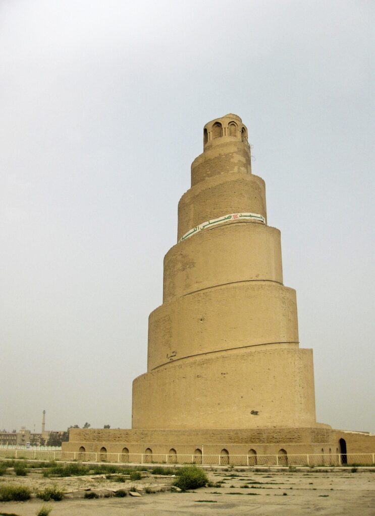
The Malwiya Minaret is the 52-metre spiral tower of the Great Mosque of Samarra, built for the Abbasid caliph al-Mutawakkil around 848 to 852, when the mosque was the largest in the world. It stands in Samarra, 120 to 130 km north of Baghdad, inside a UNESCO World Heritage property that has been on the danger list since 2007.
It is one of the most recognisable monuments in our guide to Iraq’s ancient sites, and one of the least straightforward to visit. This page covers what the Malwiya and its mosque were, the short-lived Abbasid capital around them, what has happened to the tower since, whether you can climb it, how a day trip from Baghdad actually works, the FCDO’s against-all-travel advice for Salah al-Din as of September 2026, and what nobody could confirm.
The short answer
| Question | Answer |
|---|---|
| What is it? | The spiral minaret of the Great Mosque of Samarra, 52 m high on a base about 33 m wide |
| How old? | Mid-ninth century, built for the caliph al-Mutawakkil (reigned 847–861) |
| Where? | Samarra, Salah al-Din province, on the Tigris 120–130 km north of Baghdad |
| UNESCO | Part of Samarra Archaeological City, inscribed 2007 and on the List of World Heritage in Danger ever since |
| Fee | 25,000 IQD for foreigners to enter the mosque complex (reported February 2026) |
| Can you climb it? | Sometimes. 2026 reports conflict, and nobody can tell you in advance |
| UK advice | FCDO: against ALL travel to Salah al-Din province (unchanged as of 25 September 2026) |
What is the Malwiya Minaret?
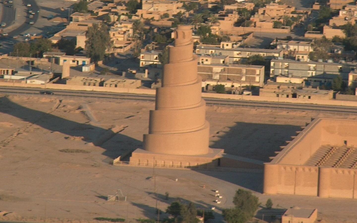
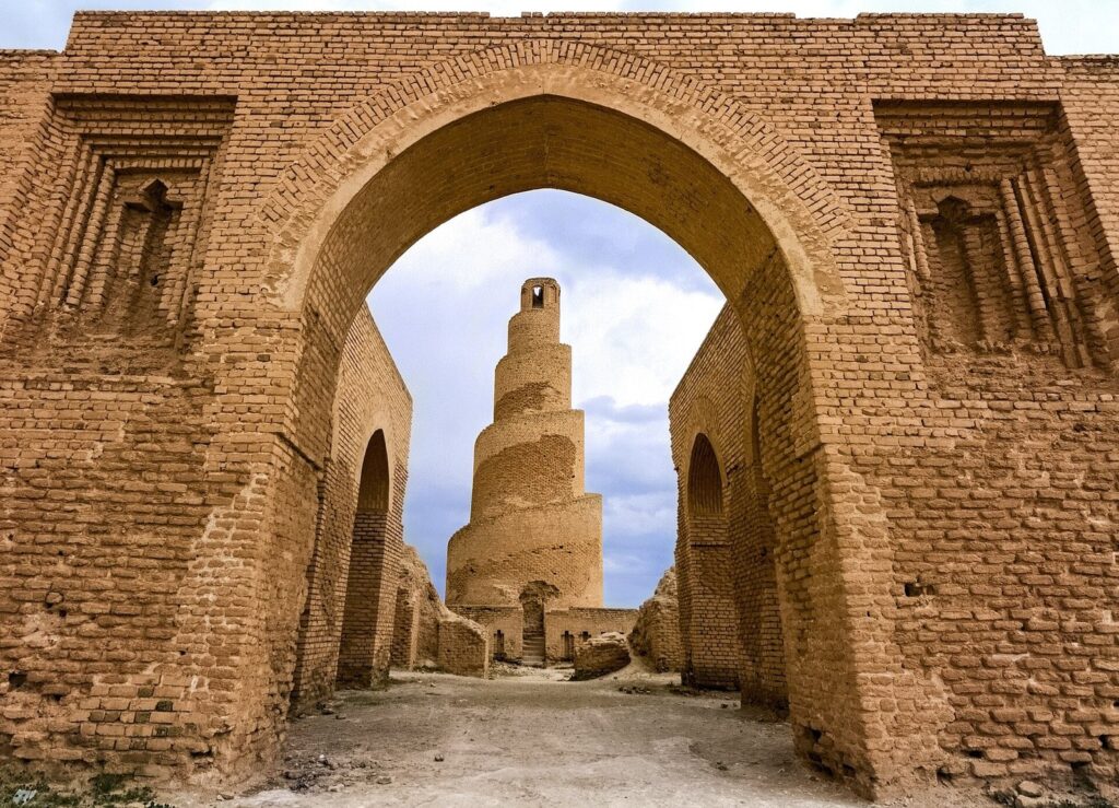
Malwiya means twisted or coiled in Arabic, and the name is the whole description: a solid brick cone, 52 metres tall on a base about 33 metres across, with a single ramp spiralling round the outside to a small pavilion at the top. The Malwiya Minaret stands on the axis of the Great Mosque, just outside its northern wall, and was originally joined to it by a bridge.
Nobody quite agrees what it was for. The obvious answer is the call to prayer, and some accounts say its height made it practical for exactly that. Others argue that a muezzin at the top of a 52-metre tower would have been barely audible below, and that the Malwiya was really a statement: a landmark visible across the flat plain, announcing the caliph’s city and the new faith in a shape the region already understood. That shape is the other argument. The spiral ramp is widely believed to echo the stepped temple towers of older Mesopotamia, such as the ziggurat of Ur, though whether the builders meant it as a quotation or simply found it a good way to build high in brick is anyone’s guess.
The design had heirs. The Mosque of Ibn Tulun in Cairo, built a generation later by a governor who had grown up in Samarra, copies the Great Mosque in many respects and has its own spiral stair on the minaret. Samarra’s second great mosque, Abu Dulaf, repeats the spiral at a smaller scale. In the twentieth century the architect Philip Johnson borrowed the form for the Chapel of Thanksgiving in Dallas (1976), and minarets at the Sheikh Khalifa mosque in Al Ain draw on it too.
The Great Mosque of Samarra: the largest mosque of its age
Al-Mutawakkil commissioned the mosque in 848 or 849 and it was finished by 850 or 851. When it was completed it was the largest mosque in the world, and even as a shell it is hard to take in. Only the outer wall and the minaret survive; the forest of columns and the roof they held have gone.
| Feature | Figure | What survives |
|---|---|---|
| Outer enclosure | About 165,886 m² (roughly 17 hectares) | Traces on the ground |
| The mosque proper | About 37,440 m² | The baked-brick outer wall |
| Wall towers | 44 semi-circular towers | Standing, restored in places |
| Doors | 16 | Openings in the wall |
| Prayer hall | 464 pillars under a roof about 11 m high | Nothing standing |
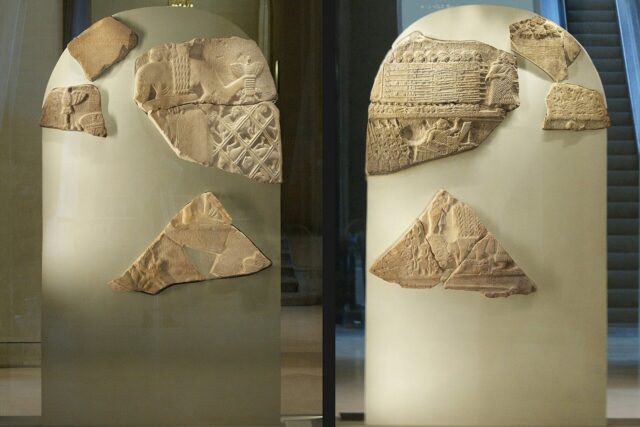
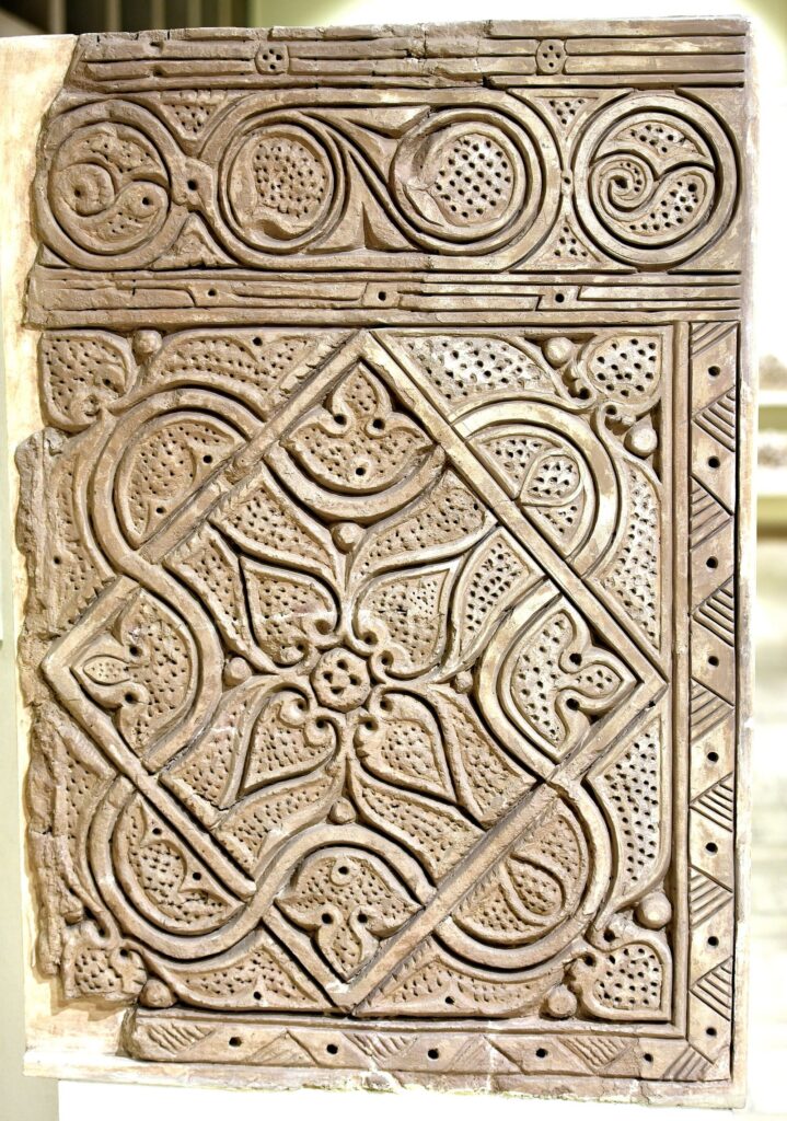
| Decoration | Glazed or glass panels and carved stucco | Fragments in museums |
| Minaret | 52 m high, base about 33 m | Standing; top damaged in 2005, restored since |
Walk inside the walls and the scale becomes a kind of emptiness: a vast rectangle of beaten ground framed by towers, the Malwiya rising beyond the north wall. It is worth doing slowly, because the courtyard is the only way to understand how many people this building was meant to hold.
Samarra, the Abbasid capital that lasted 56 years
Samarra was a capital for barely two generations and it shows: the city was built fast, huge and mostly in mud brick, then abandoned almost as quickly. The caliph al-Mu’tasim moved the court here from Baghdad in 836, partly to separate his Turkish guard from Baghdad’s resentful population, and named the new city Surra man ra’a, “a delight to whoever sees it”, which contracted over time to Samarra. It stayed the seat of the caliphate until 892, when the court went back to Baghdad.
In between, the caliphs built on a scale that is still startling. UNESCO describes an archaeological city 41.5 km long from north to south and between 4 and 8 km wide on both banks of the Tigris, and calls it “the only surviving Islamic capital that retains its original plan, architecture and arts”. With Baghdad’s Abbasid monuments almost entirely lost, Samarra is the best physical record of the caliphate at its height. The palaces borrowed freely from Sasanian Iran, down to the vaulted iwan halls you can still see at Ctesiphon, and the craftsmen developed styles that spread across the Islamic world: the carved and moulded “Samarra stucco” and lustre-painted ceramics.
It was also a violent place. Al-Mutawakkil, who built both great mosques, was murdered in his palace in 861 by members of his own Turkish guard, and the following decade of coups is still known to historians as the anarchy at Samarra.
Samarra’s main monuments
| Monument | What it is | Visitable in 2026? |
|---|---|---|
| Great Mosque and Malwiya | Al-Mutawakkil’s mosque, 848–852 | Yes, with a 25,000 IQD ticket (reported February 2026) |
| Abu Dulaf Mosque | Al-Mutawakkil’s second great mosque, with a smaller spiral minaret, about 15 km north | Unconfirmed; one operator says its minaret can be climbed |
| Dar al-Khilafa (Qasr al-Khalifa) | The caliphs’ palace above the Tigris, with its triple-arched gate | Unconfirmed |
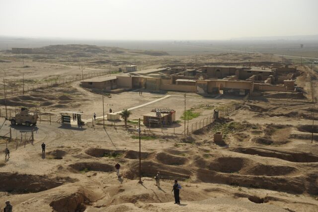
| Qasr al-Ashiq | A late ninth-century palace on the west bank, heavily restored | Unconfirmed |
| Qubbat al-Sulaibiyya | An octagonal domed building, often identified as an early caliphal tomb | Unconfirmed |
| Al-Askari Shrine | The shrine of the 10th and 11th Shia Imams, a major pilgrimage site | Exterior; entry for non-Muslims unconfirmed |
The German archaeologist Ernst Herzfeld excavated at Samarra in 1911–13, and much of what we know about the city’s decoration comes from that work. Panels of its stucco are now in Baghdad and Berlin, and the Iraq Museum shows carved panels from the site when its galleries are open.
What happened to the Malwiya Minaret?
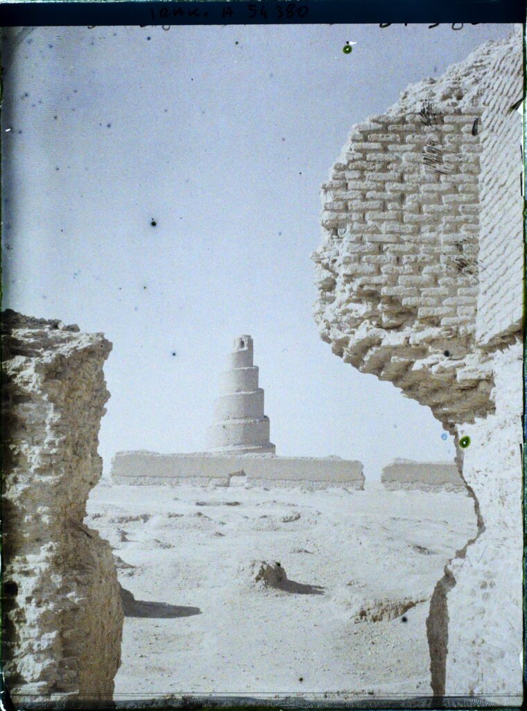
The Great Mosque was wrecked in the thirteenth century, leaving, in the usual phrase, only the outer walls and the Malwiya. The destruction is routinely pinned on the Mongol invasion led by Hulagu Khan, and just as routinely dated to 1278. Both cannot be right: Hulagu sacked Baghdad in 1258 and died in 1265. Either the date or the culprit is wrong, and the popular version is best treated as tradition.
| Source | What it says | What it actually tells you |
|---|---|---|
| Wikipedia’s Great Mosque article | Destroyed in 1278 in Hulagu Khan’s invasion, which it also dates to AH 656 (1258–59) | Two dates for one event in the same article |
| 2026 travel guides | Destroyed during Hulagu Khan’s invasion in the 13th century | The tradition, without a year |
| The historical record | Hulagu died in 1265 | A 1278 destruction cannot have been his work |
Iraq’s antiquities service began restoring the courtyard and the minaret in 1956. The modern damage came on 1 April 2005, when an explosion destroyed the top of the tower; some accounts blame insurgents, who are said to have targeted it after US forces used it as a sniper position. The tower has since been extensively restored, and in 2015 UNESCO and the Iraqi government announced a project to restore the minaret and assess the damage. UNESCO has filed a state-of-conservation report on Samarra every year or two since 2008, the latest in 2025; its assessment of the property is blunt, noting that “protective procedures have been in abeyance since 2003”.
Can you climb the Malwiya Minaret?
Sometimes, and nobody can promise it in advance. The Malwiya Minaret’s ramp is opened or closed on the day. The best-dated first-hand account in our files, from a tour leader writing in February 2026, treats the climb as a normal part of the visit and a highlight, with a warning to bring a light jacket in winter because the wind at the top is strong. Another 2026 guide says whether the ramp is open depends on the security mood of the day, and that in recent years the answer has mostly been no. Both can be true: access is decided at the gate, not published anywhere.
If it is open, think before you go up. The ramp has no railing, and it is a long way down from the upper turns. People with a poor head for heights should stay on the ground; the tower and the mosque walls are just as impressive from below. Don’t take small children up, and don’t try it in a dust storm or in the heat of a summer afternoon.
How do you get to Samarra?
As a day trip, because there is no other legal option: foreigners are not permitted to stay overnight in Samarra, and the hotels are closed. You need the federal Iraqi visa (a Kurdistan Region visa is not valid here), applied for online at least 24 hours before you travel; as of 25 September 2026 the FCDO put the fee at $160 for 60 days. Our guide to the Iraq e-visa explains the form.
Transport from Baghdad
| Option | Reported cost | The catch |
|---|---|---|
| Shared taxi from Allawi North Garage | About 15,000 IQD a seat each way; return from Samarra Garage at the same price | You deal with the checkpoint alone |
| Private charter taxi | About 30,000 IQD each way, “with some hard bargaining” | Same; the driver may not wait |
| Private car and driver from a Baghdad hotel | About US$100 for an eight-hour day | Driver may have no Samarra contacts |
| Guide with car | About US$150–160 a day | The easiest way through the checkpoint |
Those figures come from first-hand reports published in February 2026. A self-organised trip by shared taxi, with the 25,000 IQD ticket, comes to well under US$60, but you will be handling one of Iraq’s more unpredictable checkpoints on your own. The drive takes about 90 minutes each way, not counting the wait at the checkpoint, so budget a full day. For the practical side of hiring drivers see our guide to getting around Iraq, and for costs overall, what a trip to Iraq costs.
The checkpoint
The checkpoint at the entrance to Samarra has been run by Saraya al-Salam, the Peace Brigades founded by the cleric Muqtada al-Sadr, which have guarded the approaches to the city’s shrine since 2014 and serve as brigades of the Popular Mobilization Forces. In June 2026 the group announced it was cutting its ties with Sadr’s movement and integrating into state institutions, while saying it would not leave Samarra until the city’s security was formally handed over, so who staffs the gate may change. There is no published permit process: it is a gate, not a form. Visitors in 2026 report being questioned for 30 to 60 minutes, or simply held for about 45 before being waved through, and some get through with no delay at all. As one tour leader put it, it seems to depend on who is manning the checkpoint that day. Some visitors are assigned a police or military escort to the Great Mosque, and police sometimes steer new arrivals into a local taxi rather than letting them walk.
Reports also differ on what happens to your passport. One 2026 account describes handing over your passport or ID at the checkpoint in exchange for a visitor card, swapped back on the way out; another says passports were shown at a final town-entry check but not kept. It may vary by checkpoint and by season. Having a local contact helps: the same tour leader recommends lining one up before you travel. Our guide to how Iraqi checkpoints work covers the general etiquette, and a local operator from our guide to tours in Iraq will have done this run many times.
How far is it? Sources disagree
| Source | Distance from Baghdad | What it measures |
|---|---|---|
| UNESCO | 130 km north | To the World Heritage property, which is itself 41.5 km long |
| 2026 travel guides | 125 km | To Samarra town |
| General circulation | 120–125 km | Road distance, depending on the start point |
For how Samarra compares with the other trips out of the capital, including the far easier Babylon and Ctesiphon, see our guide to day trips from Baghdad.
Is Samarra safe to visit?
This is the part of the page to read twice. As of late September 2026:
- UK. The FCDO advises against all travel to Salah al-Din province, which includes Samarra. That is its highest level of warning, the same band as Nineveh, Kirkuk, most of Diyala and Anbar west of Ramadi. Its Iraq travel advice, last updated 22 July 2026, was unchanged when we checked on 25 September 2026.
- US. The State Department’s advisory is Level 4, Do Not Travel, for the whole country, reissued on 29 August 2026.
- Insurance. Travelling against FCDO advice can invalidate your cover, and against-all-travel areas are where standard policies are most likely to exclude you. Read our guide to travel insurance for Iraq before you book anything.
- The wider picture. 2026 has been shaped by the confrontation between Iran and the United States: Iraqi airspace was closed for 38 days in the spring, drones and missiles have repeatedly struck the Kurdistan Region, and the US-led coalition’s mission was due to end on 30 September 2026. As of 25 September, the EU’s aviation safety agency was telling European operators not to fly in the Baghdad flight information region until at least 30 September.
Samarra’s own history explains the caution. The bombing of the al-Askari Shrine’s golden dome in 2006 set off the worst of Iraq’s sectarian killing, and the city sat close to the front line when ISIS swept through Salah al-Din in 2014. Today it is heavily guarded, and foreigners do visit, regularly, on day trips. But the advice is what it is, and the practical constraints (no overnight stays, a discretionary checkpoint, sometimes an escort) are the local expression of it. Our pages on whether Iraq is safe to visit and on how the UK and US advisories for Iraq work set out the reasoning in full.
The Al-Askari Shrine and the rest of Samarra
The Malwiya and the Great Mosque belong to the Abbasid caliphs; modern Samarra’s best-known religious site is a Shia shrine. The golden-domed Al-Askari Shrine holds the tombs of the tenth and eleventh Imams, Ali al-Hadi and Hasan al-Askari, and the sardab, the cellar associated with the occultation of the twelfth, the Hidden Imam. It is one of the main stops on a ziyarat, the Shia pilgrimage circuit of Iraq’s shrines. Both the Malwiya and the shrine are inside the city, but the shrine has its own checkpoint, and whether non-Muslims are admitted is not reliably documented: some visitors report getting in, many do not. Plan to see it from outside.
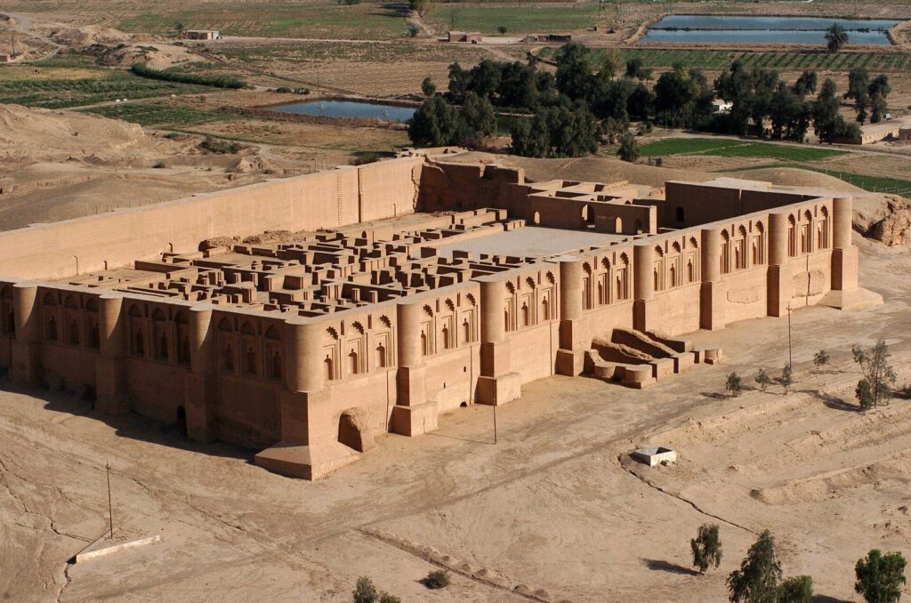
Abu Dulaf, Qasr al-Ashiq and the palace ruins are real, named parts of the UNESCO property, but we found no 2026 account of foreigners visiting them. Abu Dulaf is a separate drive, not a walk from the Malwiya; the Malwiya, the shrine and Abu Dulaf fit into one day from Baghdad only with a private car and a cooperative checkpoint. Bring your own water and food, and dress conservatively: long trousers, covered shoulders, and a headscarf for women, especially near the shrine.
What we could not confirm
- Whether the ramp is open on any given day. 2026 reports conflict, and the decision appears to be made on site.
- Opening hours. None are published for the Great Mosque complex.
- The current ticket price. 25,000 IQD for foreigners was reported in February 2026; we found no official price list.
- What happens to your passport at the checkpoint. One account describes a passport-for-card exchange, another says passports are only shown.
- Whether Abu Dulaf, Qasr al-Ashiq, Dar al-Khilafa or Qubbat al-Sulaibiyya can be visited. No 2026 visitor report mentions them.
- Non-Muslim entry to the Al-Askari Shrine. No official statement from the shrine’s custodians exists.
- The ramp’s details. Arabic sources give it as about 2 m wide with 399 steps; we could not trace the figures to a survey.
- The present restoration. Arabic sources mention a project with Salah al-Din province, UNESCO and international firms, without dates; we could not confirm its scope or status.
- Who runs the checkpoint now. After Saraya al-Salam’s June 2026 announcement, we found no report of the security file being handed over or of any change at the gate.
- A reported loosening of the rules in early 2026. We found no official announcement. The dated evidence describes a regime that is still discretionary.
Frequently asked questions
How tall is the Malwiya Minaret?
About 52 metres, on a base roughly 33 metres wide, and the figure is consistent across sources. The top was damaged by an explosion on 1 April 2005 and the tower has since been restored. The ramp winds round the outside of the tower to a small pavilion at the summit, which is where the height is measured to.
Who built the Malwiya Minaret?
It was built for the Abbasid caliph al-Mutawakkil, who reigned from 847 to 861, as part of the Great Mosque of Samarra. The mosque was commissioned in 848 or 849 and finished by 850 or 851; the minaret is usually dated 848 to 852. At its completion the mosque was the largest in the world.
Can tourists visit the Malwiya Minaret?
Yes, on day trips from Baghdad. Foreigners pay a reported 25,000 IQD to enter the mosque complex, and must pass a checkpoint run by Saraya al-Salam, where waits of 30 to 60 minutes are common. Overnight stays in Samarra are not permitted. The FCDO advises against all travel to Salah al-Din province, which can invalidate insurance.
Is the Malwiya Minaret open to climb?
Sometimes. A first-hand February 2026 account describes the climb as a normal part of the visit; another 2026 guide says it has mostly been closed in recent years, depending on the security mood of the day. The ramp has no railing, so it is not for anyone uneasy with heights.
Why is the Malwiya Minaret shaped like a spiral?
Nobody knows for certain. The spiral is widely believed to echo Mesopotamia’s older stepped temple towers, the ziggurats, and it was a practical way to build high in brick with a ramp instead of an internal stair. Some historians think the tower was as much a landmark and a statement of caliphal power as a place for the call to prayer.
Is Samarra a UNESCO World Heritage Site?
Yes. Samarra Archaeological City was inscribed in 2007 and placed on the List of World Heritage in Danger the same year, where it remains. The property covers 15,058 hectares along both banks of the Tigris, with a buffer zone of 31,414 hectares, and includes the Great Mosque, Abu Dulaf and the caliphal palaces.
Is it safe to visit Samarra?
The FCDO advises against all travel to Salah al-Din province, its highest warning, and the US rates all of Iraq Level 4, Do Not Travel, as of September 2026. Foreigners do visit on guarded day trips, but you would be travelling against official advice, probably without valid insurance. Read both advisories in full before deciding.
How far is Samarra from Baghdad?
Between 120 and 130 km north, depending on the source. UNESCO says 130 km, but measures to a World Heritage property that is itself 41.5 km long; 2026 travel guides say about 125 km to the town. The drive takes about 90 minutes each way without the checkpoint, so plan a full day.
Final thoughts
The Malwiya Minaret is one of those rare monuments that is exactly as strange in person as in photographs: a brick corkscrew standing in an empty rectangle of walls, built by a caliph who was murdered a decade later, in a capital his successors abandoned within two generations. It is the single best reason to go to Samarra, and in many ways the only straightforward one.
Everything else about the trip is conditional. The advice is against all travel, the checkpoint decides your day, the climb may or may not be open, and you have to be back in Baghdad by nightfall. None of that makes it impossible, and foreigners routinely do go. It does mean the decision deserves more thought than a line on an itinerary, and a good local contact is worth more here than anywhere else in federal Iraq.
If Samarra is out of reach, Babylon makes an easier day from the capital, Mosul’s restored al-Hadba minaret is Iraq’s other great minaret story, and our guide to Iraq’s six World Heritage Sites shows where Samarra sits among them.
Photo credits
Malwiya Minaret, Samarra (featured image): Jim Gordon, Wikimedia Commons (CC BY 2.0). Malwiya Minaret ramp: Ekhlas Sami, Wikimedia Commons (CC BY-SA 4.0). Abu Dulaf Mosque, Samarra: Omarfox ali, Wikimedia Commons (CC BY-SA 4.0). Samarra stucco panel, Iraq Museum: Osama Shukir Muhammed Amin FRCP(Glasg), Wikimedia Commons (CC BY-SA 4.0). Malwiya Minaret, 1927: Gadmer Frédéric, Wikimedia Commons (CC BY-SA 4.0). Qasr al-Ashiq, Samarra, 2008: Maj. Johnpaul Arnold, Wikimedia Commons (public domain). All images via Wikimedia Commons under the licences shown.